
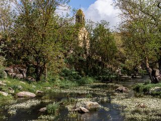
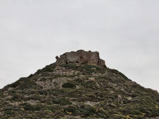
The Parco di Tuvixeddu sits on the hillside of the same name, in the working-class neighbourhood of Sant’Avendrace. It covers around three and a half hectares in an area where items have been uncovered which bear witness to human settlements since Neolithic times.
The park is home to the largest Phoenician-Punic necropolis in the Mediterranean basin, excavated out of the limestone live rock. It had been active since the VI century B.C. and remained in use up until the time of the early Roman empire.
This is a monumental necropolis featuring mainly well tombs. These tombs have hypogeum rooms with generally rectangular layout accessible via a vertical well with sub-square section and reaching to a depth of between 3 and 7 metres.
At the bottom of the well is a rectangular opening which provided access to the room. The stone slabs shut off access to the tombs to protect the dead buried there and their funeral goods, now housed at the National Archaeological Museum in Cagliari.
Some of the tombs inside have simple decorative motifs like red stripes painted on the walls. In some cases, on the outside, above the entrance, they have paintings or bas relief sculptures, horrible masks or symbols like the solar disc and crescent moon.
Two tombs are particularly striking with their internal decoration.
The first one, known as Tomba di Sid or the Warrior’s tomb, presents a niche on either wall with the exception of the one where the entrance opens out. A red Baetylus triad is painted inside each niche. On the upper part of the walls is a frieze made up of circles outlined in red and filled in with blue, supported by painted pillars in red resting on spiral capitals. On one of the walls, a male figure with beard is outlined in red, shown standing with head covered by a helmet, bare chest with hips strapped by a cloth, in the process of throwing a lance. It is believed that this figure represents a warrior or the Punic god of hunting, Sid.
The second burial, finely decorated is known as the Tomb of the Uraeus. It takes its name from the snake holy to the Egyptians represented on the wall in front of the entrance to the cell. The snake has wings and has a solar disc on top of it. On the sides are two lotus flowers and two masks with Gorgon face. Along the edges of the cell are strips of ochre red with palmette or even lotus flowers.
After the III century, the Romans extended the necropolis digging chamber, cremation and pit graves. Evidence from the Roman era is mainly visible in the part of the necropolis overlooking Viale Sant’Avendrace.
A columbarium, known as the Tomb of Rubellio, stands out among the tombs from the Roman era. The wall epitaph on the entrance to the tomb mentions a Caio Rubellio, probably the owner of the tomb.
A monumental tomb, on the other hand, is that of Atilia Pomptilla. This is a funeral hypogeum whose facade, carved out of the rock, reproduces that of a small temple in mixed Ionic style. The tomb is known as the Viper’s Cave due to its decoration with two snakes facing each other engraved on the epistyle. It was commissioned by her husband, Lucio Cassio Filippo who dedicated verses full of love to her like these: “May your ashes, oh Pomptilla, fertilised by the dew, sprout violets, lilies and green leafy branches with protruding roses, smelling of saffron and amaranth houseleek. May you become in our eyes the flower of beautiful spring”.
In the Middle Ages, with the destruction of the city of Santa Igia, a large number of survivors adapted the tombs to use as homes. More recently, the area was used firstly as a quarry for the production of cement, then as an anti-aircraft shelter during the bombings in the Second World War.
From the 1960s onwards, work by the Heritage Authorities has been ongoing to protect and recuperate it and, with the creation of the park in 2014, the area was finally opened to the public.


