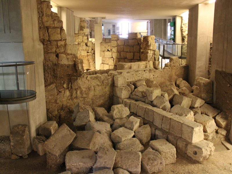
The archaeological area of Sant’Eulalia extends across 900 m2 underneath the church of the same name, in the Marina neighbourhood. We can see buildings linked to the changes in the inhabited centre from the IV century B.C. to the XIX century A.D. In the late Punic era (IV-III B.C.), the area of Sant’Eulalia was situated in a peripheral part of Krly, the Punic name for Cagliari. A sanctuary used as early as the Roman-Imperial age (I B.C.) was erected in that area.
Around the IV-V centuries A.D., the area became a residential housing area, served by a wide paved road and a colonnade. The city, now known as Karales, had its hub in the current-day Piazza del Carmine and so the area of Sant’Eulalia belonged to an eastern neighbourhood. Around the VII century, the city underwent some changes that led to the abandonment of the more peripheral sectors due to the instability caused by invasions from the sea. This was how the area was gradually abandoned and down through the centuries became covered over with earth.
On reaching Cagliari in 1326, the Catalan-Aragonese created a well-organised residential neighbourhood in this area where they built a church dedicated to the patron saint of Barcelona, Sant’Eulalia. Between the XVII and the XVIII centuries, an initial central crypt was built underneath the building’s paving, followed shortly after by five family-member ones on either side. In 1990, following works to the sacristy, a part of the area was uncovered. This is how the excavation work began and which continued for about twenty years.
The archaeological site of Sant’Eulalia is part of the Mutseu System, together with the Museo del Tesoro and the three churches of Sant’Eulalia, Santo Sepolcro and Santa Lucia.


